Sunday, October 26, 2008

Streetcars, Version 2.0

I know it's been a long time since I posted my last streetcar map, but school has kept me extremely busy lately. I've been working on incorporating your suggestions and I think I've developed a better map. I'll let you judge that for yourselves, however.

Like all of my plans, this is a conceptual best-case scenario based on what I think the region can support right now. This is not meant to reflect what I'd like the streetcar network to look like in 15 years, it's what I'd like it to look like tomorrow. Since that is clearly not possible, I'd be happy if any one of these proposals, in part or in whole, was constructed.


Mainly, this plan is to stimulate discussion. If we're lucky, this plan, or one of my readers, will spur the District Council into action. And even if we're not that lucky, this represents a vision for the region of what we could become. Plus it's fun for me. I hope you enjoy reading it as well.

From the Streetcar Plan 1.0:

I chose lines based on connection commercial nodes. I know that some of the
lines are long. Not very many people will ride from Friendship Heights to the
National Archives, but that’s not the point. I once heard Portland’s Streetcar
referred to as a “pedestrian accelerator.” The point in to expand the range of
people going on foot, encourage redevelopment, and offer alternatives.

Streetcars would operate like Portland Streetcar, with traffic in shared lanes. Vehicles would be similar to those used on Portland Streetcar and the South Lake Union Streetcar in Seattle.

One final note: Station locations are conceptual. I picked certain intersections because they were evenly spaced or home to a major commercial node. There may be better stops that should be included, and I imagine that studies will be undertaken before any construction begins. Feel free, however, to make suggestions.

14th Street/Capitol Hill Line
This line, shown in dark blue on maps, starts in Northwest at the intersection of 16th Street and Gallatin Street. This stop, near the Rock Creek Tennis Center, would be a transfer point to theWestside Light Rail proposed in my Major Transit Plan. The line runs south along 14th through downtown, turning east on D Street SE to jog over to 7th Street at L'Enfant Plaza. Turning south on 7th, the line heads for the Waterfront. Passing through the Riverfront District
on M Street, the line heads for Barracks Row. A loop is located at the M/8th Street intersection to short-turn streetcars. The line continues north on 8th Street through the historic district. The line crosses Pennsylvania Avenue and turns right onto Independence Avenue, then north on 19th Street. Jogging over to Oklahoma Avenue on D Street, the line enters a loop at Oklahoma Avenue & Benning Road, site of the Oklahoma Avenue Station on my proposed Silver Line/H Street Subway.

Wisconsin Avenue/Anacostia Line
This line, colored purple on the map, runs across town, with a branch at either end. On the west end of the line, trains head from Georgetown to Friendship Heights or the Court House section of Arlington. At the east end of the line, trains cross the 11th Street Bridge over the Anacostia and follow MLK to Congress Heights or Good Hope Road to Naylor Road Metro.

The Friendship Heights Branch is unchanged from version 1.0. Turning at a loop at Wisconsin and Western, the line runs down Wisconsin to Georgetown where it meets the Arlington Branch.

The Arlington Branch is also unchanged from version 1.0. Trains operate from Georgetown to Court House Metro by way of the Key Bridge and Wilson Boulevard.

From Georgetown, trains from both branches operate down Pennsylvania Avenue to K Street, after going around Washington Circle. Passing through downtown on K Street, the line jogs around the south side of Mount Vernon Square, turning southeast onto Massachusetts Avenue. Past Union Station, the line continues (on a new alignment from version 1.0) down Massachusetts to 2nd Street. At Pennsylvania, the line turns southeast in the median running as far as 8th, where it turns south. Along 8th, the Wisconsin/Anacostia Line is multiplexed with the 14th Street Line as far as M Street. Turning east on M Street, the line climbs onto the proposed 11th Street Bridge over the river. On the south shore, trains split into the two branches.

The Good Hope Branch goes through the center of old Anacostia. Passing through Southeast DC, the line crosses Alabama Avenue and turns south onto Naylor Road. At the DC Line, the streetcar enters Maryland and goes around a loop at the Naylor Road Metro Station.

The MLK Branch travels past the Anacostia Metro Station on its way to Congress Heights. At South Capitol and Mississippi Avenue, the streetcar turns around at a loop. Transfers are available here to the Eastside Light Rail proposed in my Major Transit Plan.

H Street/State Department Line
This line, which is light blue on the map) is relatively unchanged from version 1.0. The only difference is that I've extended it across the Anacostia River on the Benning Road Bridge to feed into a new station I am going to propose on my plans at River Terrace, a la Greater Greater Washington and Imagine DC.

The line runs from the State Department up 23rd Stret to Washington Circle, thence east on K Street (along with the Wisconsin/Anacostia Line) to Mount Vernon Square. From Mount Vernon Square, it turns southeast on Massachusetts Avenue past Union Station to D Street NE. The line uses a pair of one-way streets (SB on 4th NE, NB on 6th NE) to get up to H Street. The line sticks with H Street and Benning Road to a loop at River Terrace Metro.

Connecticut Avenue Line
This line (green on the map) starts at Chevy Chase Circle, and proceeds south through Northwest to Dupont Circle. Turning south on 20th Street then east on Eye Street, the line crosses downtown. A turn down 12th Street takes cars past Metro Center. Turning east on Constitution then north on 7th, the line reaches its end at a loop at 7th & Indiana.

Georgia Avenue/Mount Pleasant Line
Starting at the old streetcar loop in Mount Pleasant, this line, colored orange, travels south on Mount Pleasant Street to Columbia Road. Turning southwest on Columbia, the line is multiplexed with the Crosstown Line for several blocks. At 18th, the line turns south to travel through Adams Morgan's commercial corridor. Turning right on Q Street, the line crosses Connecticut Avenue and follows the Connecticut Avenue Line through downtown. From 7th & Indiana, the Georgia Avenue Line continues north on 7th Street, past Gallery Place Metro. The line follows 7th Street/Georgia Avenue to Silver Spring, where it terminates at the Silver Spring Transit Center, which is currently under construction.

Rhode Island Avenue Line
This line, also colored orange, is part of the Georgia Avenue Line. Sharing the downtown portions of its line, it runs from a loop at 20th and L NW to Mount Rainier. Splitting from the Georgia Avenue Line at 7th and Rhode Island, the Rhode Island Avenue Line travels northeast on Rhode Island all the way to Mount Rainier. At Mount Rainier, it turns back on a siding at Rhode Island Avenue and Perry Street.

Boundary Street Line
This line has undergone a few changes since version 1.0 based on your comments. In the east, it starts at River Terrace on the opposite bank of the Anacostia. This change was made because I'm including a stop there in the next version of my metro proposal. Traveling westward, the line follows Benning Road and Florida Avenue. Turning onto U Street, the line crosses through Washington's L'Enfant City. At U and New Hampshire, the line turns southwest, intersecting the Georgia Avenue Line at 18th Street. Turning west on Q, the line heads toward Georgetown. At Wisconsin, the line turns south and joins the Wisconsin Avenue Line. Turning right at M Street, passengers can change to the metro at the proposed Georgetown stop. Trains then enter a loop made up of one-way streets. Trains travel north on 33rd to P, where they turn west, turning south again at 37th. Here passengers can access Georgetown University. Continuing around the loop, trains turn left onto O Street, right onto 34th, and then left onto M Street.

Crosstown Line
This line has seen the most change since version 1. The Crosstown Line is colored red on the map. It runs from Woodely Park in the west to North Michigan Park in the east. From Woodely Park, it crosses the Calvert Street Bridge over the Rock Creek Gorge, turns northeast onto Columbia Road and then east on Irving after traveling north for a block on 16th. Following Irving, the streetcar passes through Columbia Heights and joins Michigan Avenue south of the Washington Hospital Center. Turning onto Monroe, the streetcar passes the Brookland Metro stop, and after a turn onto 12th, passes through the center of the Brookland neighborhood. Continuing north on 12th, the line once again follows Michigan, ending at a loop at Michigan and Eastern.

Maintenance/Storage:
The streetcars need a place to be stored overnight and also a venue where maintenance can be performed. If other cities examples can be followed, new development along the corridor could be made to accommodate a trolley barn as a condition of zoning approval.

At least two locations do seem to have immediate potential, however. At Oklahoma Avenue Metro, the parking lots at RFK will be redeveloped. However, it seems possible that room for Trolleys could be left somewhere on site. Additionally, if non-revenue tracks led south from Rhode Island Avenue along Eastern Avenue near Mount Rainier, a Trolley storage/maintenance facility could be constructed on the industrial sites south of the CSX Capital Subdivision (MARC Camden Line).

I've also included a few other potential trolley barn locations, but these are just conceptual ideas. check out the google map to find their locations. Again, they could be sited in new development and would not be obtrusive.

Additionally, it might be possible to return WMATA’s Northern Bus Garage in 14th Street Heights to trolley service.

Non-Revenue Tracks
I've included on the google map version some potential non-revenue connections. These are tracks that would link lines together for easy movement of rolling stock, but would not be used for passengers. They are shown in black.


View Larger Map

What other corridors do you think would support a streetcar?

Saturday, October 25, 2008

A Californian Railvolution

Last year, I had the wonderful opportunity to travel to Miami to attend my first Railvolution. This year, I'm going again.

The conference will be in San Francisco this year, and I will certainly be reporting back on the conference and the state of transit in the Bay Area.

Perhaps I'll see some of you there. If not, I apologize in advance for light posting over the next week.

Start saving up for a trip to Boston for next year's conference!

Friday, October 24, 2008

Recession Threatens Transit

In September of 1929, the City of New York proposed an ambitious 100 mile proposal for what was known as the IND Second System. The plan would have greatly improved service on the city's subways and would have increased access for residents. Remnants of the plans remain to this day with unused platforms and tunnels, but by and large, the plans are lost to history.

Before the ink on the plans was even fully dry, America and the world were struck by the disastrous October 24, 1929 crash of the stock market. The dreams of transit planners weren't the only ones shattered on that black Thursday, but the consequences have been long-lasting for New Yorkers, whose subway system hasn't launched a major expansion since the 1940 unification of the three systems.

Today, I fear similar consequences will ripple out from the Credit Crisis.

Six months ago, Americans were languishing with high gas prices and were clamoring for alternatives. People wanted to reduce their dependence on foreign oil, they wanted to expand transit, and they were thinking about moving to more walkable neighborhoods.

Now, the recession has knocked the legs out from under gas prices, which have dropped precipitously in the last month. The price of oil has dropped to under $70, down from a peak of $147 in July. Whether Americans will start driving more as a result is as yet unknown, but the consequences may be severe for the environment and for new urbanism.

Also, with many Americans out of work, initiatives, like California's High Speed Rail vote, which will be on the ballot this November may suffer. Taxes are rarely popular, but sometimes Americans are willing to tax themselves to improve communities. Recessions are never a good time for these initiatives, and 2008 might not turn out to be such a great year for transit after all.

But the consequences of the Credit Crisis are already manifesting themselves. The Washington Post reported today that WMATA and other transit agencies are having their debts called in by banks in the face of AIG's collapse. Apparently, one Belgian bank has demanded that Metro fork over $43 million by next week.

The situation is certainly a complicated one, but the federal government encouraged transit agencies to leverage funding from the private sector by selling interest in rolling stock to banks. Since transit agencies are exempt from taxes, the banks got a large write-off. Don't worry, FTA approved all the deals and there was nothing illegal going on.

The hitch comes into play, however, because the third-party guarantor in most cases was financial giant AIG, whose woes over the last few weeks took all the deals into default. Because the IRS will grant amnesty to companies that drop their tax shelters by the end of 2008, banks are under a lot of pressure to kiss the transit agencies goodbye.

WMATA, which made around $100 million between 1997 and 2003 is potentially on the hook for quite a pretty penny. And they're not alone. According to the Post's article, transit agencies in Los Angeles, San Francisco, Atlanta, and Chicago could all face major service cuts or other financial hardships as a result of this fiasco.

It would be a shame for the economic crisis to kill plans for transit expansion, especially after the momentum that transit has gained over the last few months. How the government deals with the economic situation and America's infrastructure problems will depend very much on who is elected in a little less than two weeks.

Transportation reauthorization is coming up next year with the expiration of SAFTEA-LU. This could be an opportunity to redefine the way America approaches infrastructure and metropolitan planning. But the threat is very real that the Credit Crisis will divert needed attention from transportation. And with falling energy prices, Americans might go back to the illusion that they can continue to drive SUVs everywhere indefinitely.

I hope I'm wrong. I hope that this all blows over, not only for transit's sake, but because a recession is never a good thing--for anyone. Still, we cannot afford to ignore the plight of transit. Perhaps the Treasury Department has a bailout with the transit authority's name on it.

Thoughts?

Friday, October 17, 2008

Purple Line DEIS Released

The Maryland Mass Transit Administration has released the Draft Environmental Impact Statement for the Purple Line. The document, sprawling across 251 pages offers a comprehensive look at the alternatives proposed for the transitway.

Running approximately 16 miles from Bethesda in Montgomery County to New Carrollton in Prince George's County, the line will be either Bus Rapid Transit (BRT) or Light Rail and will cost between $386 million and $1.6 billion depending on the selected alternative.

The DEIS does not make for light reading, but it does cover a variety of important topics, from environmental justice to watershed impacts. Ridership and cost projections are also included, and this document is an important step in getting federal money to complete the project.

The project will play a vital role in connecting the region. Even the lowest investment BRT alternative is expected to garner 40,000 daily boardings by 2030. The high investment light rail line would draw over 68,000 riders by 2030.

The DEIS does not identify a locally preferred alternative (LPA). The decision about which mode and alignment will be made after public comment on the DEIS. According to the document:

After consideration of comments received the State of Maryland will select a Locally Preferred Alternative in consultation with county and local jurisdiction officials and elected officials. The selection will be based on consideration of, and trade off among benefits, costs, environmental impacts, and affordability of the alternatives. The Locally Preferred Alternative could include project implementation phasing that involves an initial implementation phase, referred to as a minimum operable segment, and a plan and schedule for subsequent implementation phases.
(DEIS, page 13)

Selection of an LPA would allow the MTA to undertake the engineering required for the Final Environmental Impact Statement (FEIS) which is the last major step before requesting a record of decision from the Federal Transit Administration.


The DEIS can be accessed here (warning, large PDF).
Other documents are available on the Purple Line website.

Meetings are being held around the region soon. Make sure to get your comments heard.

New Carrollton
Saturday, November 15
10:30AM-3:00PM
New Carrollton Municipal Center
6016 Princess Garden Parkway
New Carrollton, MD 20784

Chevy Chase
Tuesday, November 18
4:30PM-9:00PM
National 4-H Youth Conference Center
7100 Connecticut Avenue
Chevy Chase, MD 20815

College Park
Wednesday, November 19
4:30PM-9:00PM
Ritchie Coliseum, University of Maryland
Route 1 across from Rossborough Inn
College Park, MD 20742

Takoma Park/Silver Spring
Saturday, November 22
12:30PM-5:00PM
Montgomery College,
Takoma Park/Silver Spring Campus
Falcon Hall
7600 Takoma Avenue
Takoma Park, MD 20912

Thursday, October 16, 2008

Ridership Higher, Service Being Reduced

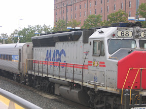
Despite rising ridership on Maryland's MARC train, MTA is proposing service cuts, beginning before year's end. MARC is a commuter and regional rail service operating between Washington and Baltimore, with limited service north of Baltimore, and between Washington, Frederick, and Martinsburg, WV.

Just a few months ago, MTA was proposing an expansion of MARC service, including weekend service on the Penn Line and midday service on the Camden Line. Governor Martin O'Malley had named MARC expansion one of his top priorities and the ambitious MARC Expansion Plan called for a tripling of MARC Service by 2035.

With high gas prices, MARC ridership was way up. Many trains are standing room only leaving Washington Terminal, including some trains that still have standing passengers when they arrive in Baltimore.

But the slowing economy has led to decreased revenues. The governor has ordered across-the-board cuts, and MTA is not exempt. In addition to reductions in service on commuter bus lines, MARC will be taking a hit too. The proposed cuts are listed below. They will go into effect on January 12, 2009 except for holiday service cuts, which will go into effect sooner.

These cuts are part of a phenomenon being seen across the nation. They are indicative of a transportation funding mechanism which is broken. Although Maryland claims to be a smart growth state, cuts to transit are affecting thousands of commuters, while construction continues to progress on the sprawl-inducing Intercounty Connector (ICC). These cuts come at a time when we are trying to reduce our dependence on foreign oil and when we are trying to reduce the climate impacts of our auto-centric society.

The state is between a rock and a hard place, and I certainly understand the need to cut spending. However, these cuts will take Maryland in the wrong direction. America's transportation infrastructure is decaying, transit ridership is up, and smart growth continues to blossom. Now is not the time for cuts to MARC service.

Please write to MTA and your local legislator and governor O'Malley to object to these cuts. A letter to the presidential candidates wouldn't hurt either. Next year may prove to be a watershed year for transportation investment--or the year we let it all go down the tubes. If the economy is issue number 1, transportation is issue number 2. It influences our environmental, energy, urban, and foreign policies and we cannot afford not investing in it any longer.

Hearings are being held throughout the region on the proposed MARC cuts. The schedule is available here.

Comments regarding these cuts may be made to MTA:
By Mail:
Mr. Glenn Litsinger
MTA Office of Customer Information
6 St. Paul Street
Baltimore, MD 21202

By Email:
marc@mtamaryland.com
“Hearing Comments” as subject

ALL COMMENTS MUST BE RECEIVED BY 5PM, MONDAY, DEC. 26

Currently proposed for elimination:

Evening Service: Penn Line trains 445, 446, 447, & 448
This cut will eliminate two round trips from Washington to Baltimore. Currently, the last train leaves Washington for Balto. at 11p, arriving at Penn Station at 11:59p. The last train leaving Baltimore for Union Station is at 9:30p, arriving at 10:35p. With the cuts, the last Baltimore-bound MARC train will leave DC at 8:40p and get into Baltimore at 9:36p. It will continue on to Perryville. After the cuts, the last MARC train bound for Washington will depart Baltimore at 7:25p and arrive in Washington an hour later.

Brunswick Line Service: Train 871 eliminated Mon-Thur
The proposed cuts will eliminate the first departure from Washington on the Brunswick Line Mondays through Thursdays. The existing 1:45p departure will remain on Fridays, but on the other four days of the week, the first train to go to Brunswick will depart at 3:35p.

West Virginia Service: Cutback of Train 883 to Brunswick
The cuts will also reduce service at MARC's three West Virginia Stations to 2 outbound trains. The last Brunswick line departure will remain 7:15p, but Train 883 will stop at Brunswick. Passengers headed to Harpers Ferry, Duffields, and Martinsburg will have to catch the 5:35p departure of Train 879 in order to get home.

Elimination of Holiday Service:
While MARC already doesn't operate on Martin Luther King Day, President's Day, Memorial Day, Independence Day, Labor Day, Thanksgiving, Christmas, and New Year's Day. MTA also proposes to eliminate service on Columbus Day, Veterans' Day, the day after Thanksgiving, and December 26.

Reduction of Winter "Holiday" Service:
On December 24th, January 2, and the period from December 27 to December 31, MARC will operate only holiday service. Currently, trains operate on a full schedule on these days.

Laurel Bus Connection: Elimnation of Odenton Shuttle
The cuts will eliminate the shuttle bus which operates from Odenton to Laurel completely. This is a far cry from the proposed implementation of midday service on the Camden Line. This bus currently represents the only way to use MARC to get to the Laurel area between rush hours.

Wednesday, October 8, 2008

Confessions of a Foamer

I have to confess that I am an unabashed Foamer. For my whole life, I've been fascinated by trains. I don't know why this is the case, but I certainly live up to the moniker given to railfans by foaming at the mouth at the mere sight of a train. I am particularly interested in transit, again for reasons beyond my comprehension. This proclivity has labeled me as a "metrophile".

One of my life goals is to ride every rail transit system in America. I've done a fairly good job, I think. There are plenty left for me to visit. I have finished riding all the systems in Canada, but that trip didn't get me any closer to my American goal.

I've created this map to show the heavy, light, and commuter rail systems in the United States. For simplicity's sake I've left off other modes, but they are mentioned below. This is a diagrammatic map, it does not represent actual alignments.

I've listed the all of the Rail Transit Systems in the United States below. I have ridden those in boldface. I did not include heritage streetcars or systems that are completely self-contained, such as airport people movers and the like.

Heavy Rail (11/13, 85%)
  • Atlanta: MARTA
  • Baltimore: Metro Subway
  • Boston: T (Red, Orange, Blue)
  • Chicago: L
  • Cleveland: Red Line
  • Los Angeles: Metro (Red, Purple)
  • Miami: Metrorail
  • New York: PATH
  • New York: NYC Subway
  • Philadelphia: PATCO Speedline
  • Philadelphia: SEPTA (BSS, MFSE)
  • San Francisco: BART
  • Washington: Metro

Light Rail (10/24, 42%)

  • Baltimore: Light Rail
  • Boston: T (Green)
  • Buffalo: Metrorail
  • Camden-Trenton: River Line
  • Charlotte: Lynx
  • Cleveland: Blue/Green Lines
  • Dallas: DART
  • Denver: The Ride
  • Houston: Metrorail
  • Jersey City: Hudson-Bergen Light Rail
  • Los Angeles: Metrorail (Blue, Green, Gold)
  • Minneapolis: Hiawatha Line
  • Newark: City Subway
  • Philadelphia: SEPTA (Subway-Surface, Routes 101/102)
  • Pittsburgh: T
  • Portland: MAX
  • Sacramento: Light Rail
  • Saint Louis: Metrolink
  • Salt Lake City: TRAX
  • San Diego: Trolley
  • San Diego: Sprinter
  • San Francisco: Muni Metro
  • San Jose: VTA Light Rail
  • Tacoma: Link

Light Rail Under Construction

  • Phoenix (Dec. 2008)
  • Seattle (summer 2009)
  • Norfolk (2010)

Commuter Rail (7/20, 35%)

  • Albuquerque: Railrunner
  • Boston: T (Purple)
  • Chicago: Metra
  • Chicago: South Shore Line
  • Dallas-Fort Worth: TRE
  • Los Angeles: Metrolink
  • Miami: TriRail
  • Nashville: Music City Star
  • New Haven: Shore Line East
  • New York: Long Island Railroad
  • New York: Metro-North
  • New York: NJ Transit Commuter Rail
  • Philadelphia: SEPTA Regional Rail
  • Salt Lake City: Frontrunner
  • San Diego: Coaster
  • San Francisco: Caltrain
  • San Jose: ACE
  • Seattle: Sounder
  • Washington: MARC
  • Washington: VRE

Commuter Rail Under Construction

  • Portland (Jan 2009)
  • Austin (April 2009)

Modern Streetcar (1/3, 33%)

  • Portland, Portland Streetcar
  • Seattle, South Lake Union Streetcar
  • Tampa, TECO Streetcar
Miscellaneous (1/7, 14%)
  • Detroit: People Mover
  • Jacksonville: Skyway
  • Las Vegas: Monorail
  • Miami: Metromover
  • Morgantown: PRT
  • Philadelphia: Norristown High Speed Line
  • Seattle: Seattle Center Monorail

Friday, October 3, 2008

Candidates and Transportation

As you're all aware, election day is rapidly approaching. Some Americans have already gone to the polls to vote, and this election sure is shaping up to be an exciting one. I talked about the candidates views on energy recently, and now it's time to address Track Twenty-Nine's issue number 1: Transportation.

In regards to transportation, the candidates are about as far apart as two people can be. Well, actually, I'll try and be more accurate: they're about as far apart as two politicians can be. My views are somewhat further from Senator McCain's than are Senator Obama's.

The largest difference between the candidates is at the fundamental level. Both agree that Americans need to reduce our dependence on foreign oil, but the similarities end there. Senator McCain may want to lower the amount of oil that we import, but he does not see reducing dependence on the automobile as a solution. In fact, many of Mr. McCain's policy positions seek to increase America's automobile addiction. Instead of sending our country into detox, he's just exchanging our foreign-cut with domestically extracted oil.

Senator Obama, on the other hand, wants to give Americans alternatives to driving. He also wants to reshape federal policy so that our communities can be made more walkable, livable, and transit-friendly. He recognizes the dire state of our nation's infrastructure and seeks to create funding sources, including leveraging private dollars, to keep our bridges from falling down and to keep our trains on track.

Senator Obama's pick for Vice President also earns him a gold star in my book for good transportation decision making. Senator Joe Biden has been commuting to Washington from his home in Delaware by Amtrak since he took office in 1973. He has long been an outspoken supporter of rail in this country, something that he will likely continue to advocate for as Vice President.

Senator McCain picked the governor of Alaska as his running mate, and that does not bode well for his credentials, at least not in the transportation sector. After clamoring for an earmark to build a bridge to Gravina Island, Governor Palin cancelled the bridge when the political tide turned against it. She still built the road to it anyway, and without the bridge, it's even more of a waste. At least with the bridge, people would have used the road.

Here's a brief breakdown of the candidates' positions:
Lists are not exhaustive.

Senator Barack Obama's Transportation Platform:
  • A top priority of the campaign is to strengthen our existing infrastructure.
  • Will create 1 million jobs through transportation investment.
  • Would create a National Infrastructure Reinvestment Bank to enhance and supplement federal transportation funding.
  • Leverage private investments through the infrastructure bank.
  • Supports federal funding for Amtrak.
  • Supports the development of high-speed passenger and freight rail systems.
  • Will double JARC funding to increase access to jobs for inner-city residents.
  • Will increase funding for public transportation.
  • Wants to raise transit/ridesharing benefits in tax code to the level of driver benefits.
  • Will strengthen the role of MPOs.
  • Supports requiring states to plan for energy conservation in transportation planning.
  • Supports a carbon cap/trade program.
  • Would offer incentives to transition to/develop alternative fuels.
  • Calls for a doubling of fuel efficiency standards within 18 years.
Senator John McCain:
(Website does not specifically list transportation as an issue)
  • Has called for a suspension of the federal gas tax.
  • Supports tax credits and other incentives to encourage alternative fuel development.
  • Believes that Amtrak is a symbol of government waste.
  • Would encourage telecommuting.
  • Thinks the solution to America's energy problem is to "drill, baby, drill."
While this list cannot be exhaustive, I did my best to compile information. Senator McCain's campaign website does not put much emphasis on transportation. A search of the site for the term "transit" returned hits where he refers to oil's transit routes (as in something that terrorists or dictators could disrupt) and border transit points.

The Brookings Institution has created a nice table comparing the candidates' opinions on transportation.

This election comes at a pivotal time for America. Oil Prices are at record highs. Ridership on transit and Amtrak is higher than it has been in decades. In the south, people can't even get gasoline. Scientists tell us that without a major shift in greenhouse gas emissions, global warming will only accelerate. We cannot afford to ignore these issues, yet one candidate out there seems to find them not worth mentioning.

November 4 is a very important day for America. Make sure you remember to go vote.

Wednesday, October 1, 2008

Money, Money, Money

The Washington Post is reporting that the US Senate has approved $1.5 billion in funding for Metro. This development from Wednesday night follows passage by the House of Representatives last week and because it passed with a veto-proof margin, President Bush is unlikely to veto it.

The funding had been tied up by a lone senator from Oklahoma, Tom Colburn. He objects to all earmarks, not just ones for Metro, but the bill was finally passed as a part of a rail safety bill which will give $13 billion to Amtrak.

The funding will be doled out over the next 10 years, if matching funds can be made available by the jurisdictions. This is very likely because the District and Maryland have already set up their funding sources and Virginia has a law which requires that they match federal funds (they can't leave them to expire). Governor Kaine has promised to find the funding, amounting to $50 million a year from each of the jurisdictions, even at the expense of other transportation projects.
Just last week, Metro announced $11 billion in funding needs for the next decade. This bill will provide $3 billion toward that goal ($1.5 billion from the federal government, $1.5 billion from the states). More funding will need to be found in order to keep Metro running smoothly, but this is a giant step forward.

Incidentally, Senator Obama voted for the bill. Senator Biden did not vote on the legislation, but I think his former commute pattern speaks for itself.

Senator McCain voted against it.
Governor Palin can see Russia from her house. (Not really)

Saturday, September 27, 2008

Transit 101

I would think that a fairly obvious aspect of transportation planning is that as convenience increases, so does use. Unfortunately, this lesson is one that apparently needs to be added to the syllabus. As I said last week, the University of Maryland has been fighting the Purple Line for a while. Other universities are making similar arguments against rail plans in their areas.

The Overhead Wire reported late last week that Norfolk State University in Virginia has been successful in getting the NSU station on Norfolk's light rail system, which is currently under construction, moved away from campus. According to the Hampton Roads Pilot Online, university officials were worried that a stop so close to campus would be a security issue.

Moving the station will add $1.45 million to the cost of the project and will locate the station on the opposite side of Brambleton Avenue. Light rail patrons traveling to the Norfolk State Campus will now have to cross a 5-lane arterial. Of course, this is likely to reduce both the number of criminals and students using the train. The crucial question is which group will be more determined to get across the highway.

While the administration of UMD has decided to partake in a civil discussion regarding the Purple Line, history shows that they haven't always been so accomodating. Not only did they try and get the Purple Line stop moved away from the center of campus, they were instrumental in the 1970s in getting the Green Line station located far from campus, on the far side of College Park. One WMATA proposal put the Green Line stop under Route 1 at its intersection with College Avenue. This stop would have been adjacent to campus, but the University feared that it would increase crime. As a result, students, faculty, staff, and visitors have to endure a long walk or bus ride to campus.

UM's arguments against the Purple Line tended to be more along the lines of objections due to safety rather than crime. Of course, if the University is so concered that light rail vehicles will be a danger to pedestrians, I challenge them to remove all cars from Campus Drive regardless of the fate of the Purple Line, after all, cars are far more dangerous to pedestrians. Rethink College Park further challenged the UM's arguments by asking, among other things, why all the campus buses didn't serve the the University's proposed station location on Stadium Drive. Hopefully, the university's fears won't result in another inconvenient station location.

Another university that fought light rail is the University of Minnesota. They objected to the Central Corridor which would connect Minneapolis and Saint Paul on similar grounds as the University of Maryland. Fearing, vibration, traffic disruption, and pedestrian safety, they insisted on a subway route through campus. When that proved too expensive, they insisted on a lenghty detour around the northern side of campus. That route would have drawn too few riders, however. Finally, not wanting to be the last obstacle to the line, they wisely backed down.

These Universities, although they would benefit greatly from the increased mobility, have fought projects which would reduce their need to provide parking, increase their environmental friendliness, and make their institutions a more integrated part of the urban fabric. At long last, some are beginning to wise up. Still, these objections are likely to continue to crop up as transit officials continue to try to expand transit into new areas. Hopefully, in these debates, mobility will be the victor.

Tuesday, September 23, 2008

Good to the Last Drop?

Yesterday was carfree day here in DC. I hope some of you out there were able to commute in a carfree manner. Of course, if you weren't able to take the train or bus, everyday is a good day to start so it's not too late to reduce your dependence on oil.

Ironically, enough, across the Southeastern United States, people are being forced into reduced-car diets. Damage to our oil infrastructure by hurricanes Gustav and Ike has created oil shortages across the Southland. CNN showed gas lines in Alabama, and the Atlanta Journal-Constitution reported many stations across the state of Georgia without gas. My parents, who live about 40 miles north of Atlanta, reported that they were paying over $5.00 for gas, and that it was hard to come by. Some gas stations have even limited the amount of gas one can buy.

Gas Buddy reported prices as of
midnight, September 23, 2008

CNN seems to think that the problems are a result of panic coupled with short supplies. The main pipeline serving the Atlanta Area, Colonial, is not operating at full capacity due to the hurricanes that recently did damage in the Gulf. Additionally, gas supplies in the Atlanta area are less flexible due to restrictions on the components. The Environmental Protection Agency requires cleaner burning fuels be sold in Atlanta due to the chronic air pollution problems plaguing the city.

And while the current situation might be due to a run on gasoline in the region, the overall situation is one caused by unsustainable policies. Atlanta is one of the most sprawling regions in the country, and alternatives to driving have long been neglected. Additionally, gas taxes in Georgia are the lowest in the nation, a fact which encourages driving (while robbing the government of funds that could be used for transportation improvements).

I have pointed out before that higher gas prices will benefit Americans in the long run. Until our policies can shift to accomodate a new era in which the role of the automobile is de-emphasized, we will continue to be reliant on a non-renewable, polluting resource which comes mostly from unfriendly parts of the world.

Even publications like Time have pointed out that high gas prices aren't all bad. But a radical shift will not help the country at all. If gas prices rise (artificially or otherwise) gradually over a long period, the market will adjust and the government will have time to take up the slack with alternatives. Additionally, people will be given the opportunity to change their behavior, however, when the price change is abrupt, the economy and individuals can be seriously harmed.
This is why it is even more important that we take steps right now to shift away from oil. I talked about the candidates' positions on energy a few weeks ago, and I'm not terribly impressed with either. In the long run, however, drilling won't change much. It won't even put a dent in the trend, so I'm not worried that it will slow the transition away from oil much. What it does do, however, is focus our political attention away from the issue. It gives people false hope that they won't have to change, and that is a bald-faced lie. We deserve better from our politicians, even if we don't expect it.

I debunked the idea of the summer gas tax holiday a while back, and even though that proposal has dropped of the radar, I don't think the energy debate is any more informed than it used to be. At least not according to the rhetoric being spouted by most of the candidates out there.

But if you're still wedded to the idea of drilling (go buy a typewriter, they're the wave of the future), you should at least check out these numbers.

My home state, Georgia, will survive the firestorm of gas shortages. This time. The question is not if Georgians can make it through this price shock, it's whether they can make the changes necessary to survive the end of the oil era. Will Mr. Perdue commit to making substantive policy changes (such as transit funding and a gas tax geared toward demand reduction) or will he take his traditional tack and pray for divine intervention?

A Debate that (Finally) Makes Sense

The Purple Line is a proposed transitway which will traverse Washington's northern suburbs. Running from Bethesda in the west to New Carrollton in the east, the line will link some of the larger job centers in the Maryland suburbs and could be the stepping off point for a fully circumferential rail line around the city.

The rail line will not be the same type of service as the existing metro, instead it will be either light rail or bus rapid transit. These modes do not have to be fully grade separated from other types of traffic, and in this case, very little of the Purple Line is likely to be elevated or in subway.


The lack of grade separation has been a contentious issue for some time at various points along the proposed route, however some of the loudest discussion came from College Park, where the proposed routing would traverse the University of Maryland on Campus Drive.

The University administration called for alternative alignments, costly subway construction, and further study; while students pushed for a central location and a speedy construction process. To many, it seemed that the debate was getting us nowhere, with the University proposing new alignments seemingly every week and forcing the Maryland Transit Administration (MTA) to rehash old arguments over and over. The student government organizations at both the undergraduate and graduate levels passed resolutions calling for the Campus Drive alternative, but President Mote would not meet with representatives from those bodies to even discuss the substance of UM's objections.

Finally, however, the debate has settled down into a calm, rational discussion of the issues. The administration, reports the Diamondback, will drop its objections to the MTA-preferred alternative if MTA can allay the fears that trains will be a danger to pedestrians and disrupt research. Accordingly, MTA is studying the potential effects, from vibrations to electromagnetic radiation. They've also released revised plans for pedestrian movement and design which will truly improve the appearance of central campus.

The Purple Line is a golden opportunity for UM and the Washington region. By improving transit access, the University can reduce the footprint of its parking facilities and increase students' access to jobs throughout the region. The region will increase its mobility and will build a vital link missing from the transit infrastructure for so long. If UM's support is indeed forthcoming, this vision of Washington's future will be one step closer to reality.

The Purple Line will probably most
resemble Charlotte's new Lynx LRT

Matt is an occasional contributor to Rethink College Park. A different version of this post will appear there this week.

Sunday, September 21, 2008

Digging Down (for Transit) Means Building Up

This post is the sixth in a series of posts I am writing about lessons planners could learn from Canada. My recent trip showed me North American cities that have done a better job of managing their urban fabric than is typical south of the 49th Parallel.

The Washington region has done a decent job of building up where it has dug down for subway construction. And so has Toronto. Because of the height restrictions in DC, it's not always as obvious that we've included density with transit; however the Rosslyn-Ballston Corridor and transit nodes in Alexandria, Bethesda, and Silver Spring are easier to see.

Transit Oriented Development in Alexandria

Mid-rises in Silver Spring,
Metro/MARC in foreground

Rosslyn's transit node from across the river

Toronto is especially adept at matching density with transit nodes. They also offer a good vantage point for the geography-savvy to note this good planning. From the top of the CN Tower, one can see for many miles, and its obvious where subway stations are, even from 1464.9 feet above the city.

Can you find the subway stations?
Hint: Look for taller buildings
Looking northwest from the CN Tower


Looking north from the CN Tower,
TOD stretches toward the horizon

Success in transit goes hand in hand with success with urban development. I was in another city which has learned that lesson recently. Charlotte, North Carolina opened its brand new light rail system in November of last year, and has almost reached its 2025 ridership targets in less than 10 months. I think that a large portion of the credit for the high ridership can be given to the planners in Charlotte who, long before the rail line was a sure thing had already implemented transit-supportive, smart growth policies.

The Lynx LRT at Carson

These policies are essential to the success of transit. At the moment, Fairfax County is struggling with those issues in preparation for the Silver Line to Dulles. As I've noted here before, the largest impediment to creating walkable, livable urban centers at Tysons is the auto-oriented nature of the development and transportation systems.

Friday, September 19, 2008

Mr. Miller, Tear Down this Freeway

This post is the fifth in a series of posts I am writing about lessons planners could learn from Canada. My recent trip showed me North American cities that have done a better job of managing their urban fabric than is typical south of the 49th Parallel. Due to my other obligations, this post has been a long time coming. I apologize.

I spent 4 days in Toronto, and I was impressed with the waterfront renaissance. All along lake Ontario, parks and condos seemed to be springing up. The developments seem likely to continue to bring life to the shore of the lake.

The Gardiner crosses York St.

Unfortunately, separating the waterfront area from Downtown is a postwar era urban freeway. The Gardiner is an elevated roadway owned by the City of Toronto which runs parallel to the lakefront. It was built in the 1950s and 1960s, and like expressways across North America built for the age of the automobile it was built mainly with regard to moving cars into the city even at the expense of the urban fabric.

A ramp encircles a park at York St.

And like many cities plagued by waterfront expressways, Toronto is considering tearing it down. On the very day I walked down to the lake and under the Gardiner, the Globe and Mail ran a story on the Mayor Miller's announcement of plans to study the freeway's removal.


A look down upon the area from the CN Tower

If the freeway comes down, it will be a good step to knitting the city back together. It will give Torontonians better access to their lake. The Gardiner could easily join the list of waterfront freeways that have come down over the past couple of years: the Embarcadero, the Central Artery, and Harbor Drive have all come down and San Francisco, Boston, and Portland are all better places for it.

The Whitehurst from the Key Bridge

Closer to home, however, we still have our own example of a waterfront freeway. The Whitehurst runs for several blocks from M Street just west of 35th in Georgetown to K & 27th Streets.

The Whitehurst, as seen from
Wisconsin at the Canal

The elevated structure obscures views of the Potomac from historic Georgetown, but many residents support it, nonetheless. It serves a role in removing through traffic from congested M Street.

Looking west from Water & Wisconsin

The freeway actually runs above Water Street for most of its entire length, with businesses fronting the underbelly of this relic of DC's freeway past. Like most of the freeways in the urban core, it is a remnant of an ambitious (Robert) Moses-like plan to disembowel DC with interstates, a-la-Los Angeles.

The Whitehurst towers over
Georgetown's waterfront park

Hopefully, Washington can soon join Toronto in seeking to remove barriers to its waterfront.

Monday, September 8, 2008

Back to the Ol' Grindstone

Sorry for the light posting lately. Two weeks ago I started a new internship and just last week, I went back to school for the 19th consecutive (and final) year. I've quite a courseload this semester and as a result, posting will probably be less frequent. However, I hope to keep an interesting dialog going here at Track Twenty-Nine. Thanks for sticking with me.

Metro Service Advisory: 9/12-9/14

This weekend, Metro will be performing maintenance and inspection of the Fenwick Bridge. As a result, no rail service will be provided on the Yellow Line bridge across the Potomac River. Yellow Line trains will operate from Huntington to Arlington Cemetery from 10PM Saturday until opening Monday. Passengers traveling downtown or needing to transfer to other Metro lines must transfer to the Blue Line anywhere between King Street and Arlington Cemetery.

Metro advises passengers traveling along the Yellow Line to add 20 minutes to their travel times.

View Metro's press release here.